Here's a breakdown of what Magic Earth offers:
Offline Maps:
Magic Earth offers offline maps powered by OpenStreetMap, allowing users to navigate without an internet connection. Covering 233 countries and regions, these maps ensure users can access reliable navigation data even in remote areas or areas with limited connectivity.
Map Views:
Users have the flexibility to choose from various map views, including 2D, 3D, and Satellite options. This allows users to customize their navigation experience based on their preferences and specific needs.
Route Details:
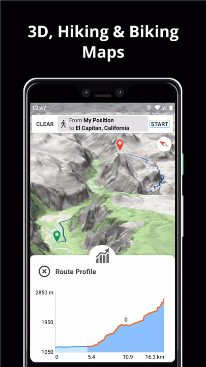
Magic Earth provides comprehensive information about routes, including surface type, difficulty level, distance, and elevation profile. This detailed insight enables users to plan their journeys effectively, whether they're embarking on a road trip or exploring hiking trails.
Points of Interest:
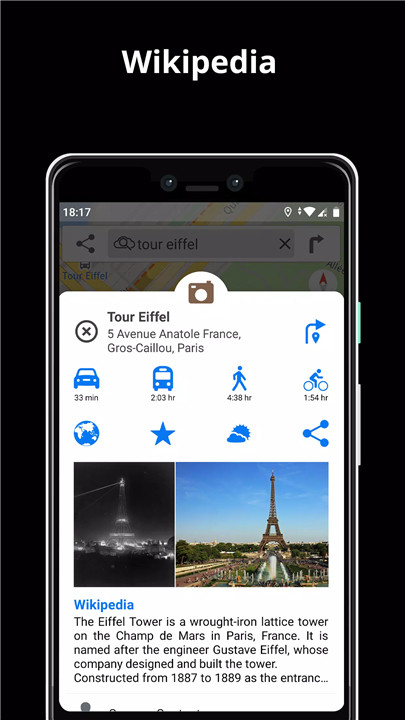
Magic Earth integration with Wikipedia articles allows users to discover nearby points of interest easily. Whether it's a historical landmark, a popular restaurant, or a scenic viewpoint, users can explore and learn more about their surroundings with just a few taps.
Regular Updates:
Magic Earth offers regular map updates at no extra cost, ensuring that users always have access to the latest navigation data. These updates include changes to road layouts, new points of interest, and improvements to overall map accuracy.
AI DashCam:
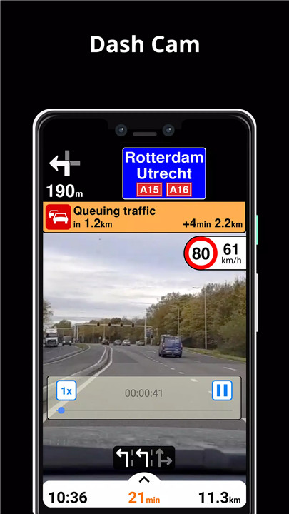
Enhance safety on the road with Magic Earth's AI DashCam features. From Driver Assistance warnings to Dash Cam functionality, the app provides users with tools to stay vigilant and alert while driving. This includes alerts for potential road hazards and the ability to record trips for added security.
Navigation Features:
Whether users are driving, biking, walking, or using public transport, Magic Earth offers a range of navigation features to suit different modes of travel. This includes turn-by-turn navigation, lane assistance, and the ability to plan routes with multiple waypoints for more complex journeys.
Traffic Updates:
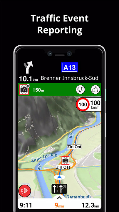
Stay informed about real-time traffic conditions with Magic Earth's traffic updates. Users can receive alerts about congestion, accidents, and road closures, allowing them to adjust their routes accordingly and avoid delays.
Here's some reasons of why Magic Earth is a good choices for users:
Public Transport Integration:
Magic Earth seamlessly integrates public transit routes into its navigation system. Users can access information about buses, metros, trains, and ferries, as well as walking directions, transfer times, and accessibility information.
Weather Forecasts:
Magic Earth provides users with current weather conditions and forecasts for their chosen locations. This allows users to plan their journeys more effectively, taking into account factors such as rain, snow, or extreme temperatures.
Privacy Focus:
Magic Earth prioritizes user privacy and security. The app does not track or profile user data, ensuring that users can navigate with confidence knowing that their personal information remains protected.
With its extensive feature set and commitment to user privacy, Magic Earth offers a comprehensive and user-friendly navigation experience for travelers around the world.
What's New in the Latest Version 7.1.24.12.55201615.5DD7D68E
Last updated on Mar 21, 2024
1. Added Google Assistant voice commands for English language (drive/walk/bike/truck/transit to, add/remove waypoint, search, mute/unmute navigation/warnings/all sounds, show weather/next traffic event).
2. Traffic event info and safety camera info are now displayed inside a dialog view.
3. Bugs fixing and stability improvements.




Ratings and reviews
There are no reviews yet. Be the first one to write one.