Handy GPS (subscription) APK
43.6
Handy GPS (subscription)
Handy GPS (subscription) APK
Download for Android
Discover the ultimate companion for your next outdoor journey with Handy GPS. This app allows you to search, track, log, and navigate your way back home seamlessly.
To access all features, an annual subscription is required; the app will still function with limited capabilities if the subscription is not purchased.
Handy GPS serves as an essential navigation tool for a variety of outdoor activities, including hiking, cycling, kayaking, mountaineering, horseback riding, and geocaching. It is also beneficial for applications in surveying, mining, archaeology, and forestry.
User-friendly and operational even in the most remote areas, it does not rely on network connectivity. Whether you’re navigating with UTM or latitude/longitude coordinates, it pairs well with traditional paper maps.
Important:
• For reliable track logging while your phone's screen is off, make sure to enable GPS use at all times and disable battery optimization for the app.
Core Features:
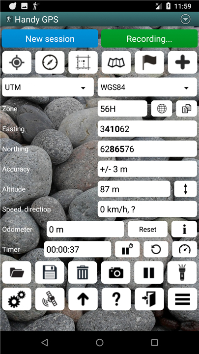
• Displays current coordinates, altitude, speed, direction, and distance traveled in metric, imperial, or nautical units.
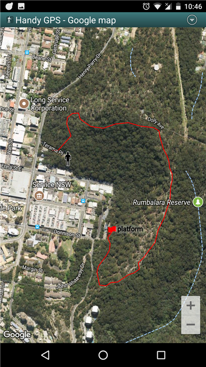
• Save your current location as a waypoint and log your route for mapping.
• Import and export data using KML and GPX files.
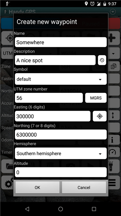
• Manually enter waypoints in UTM, MGRS, or lat/lon formats.
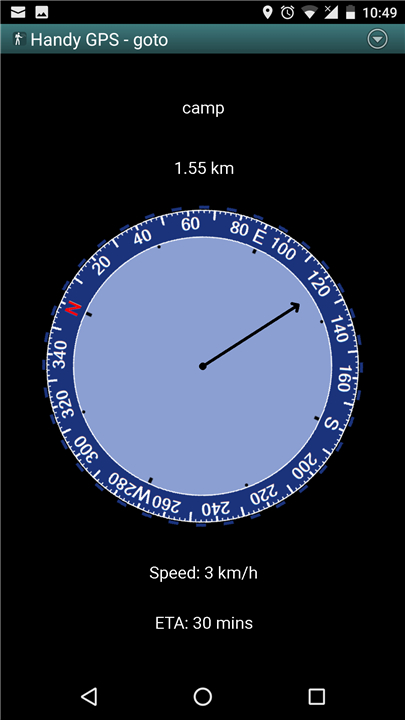
• Navigate to waypoints using the "Goto" screen, with optional proximity alerts.
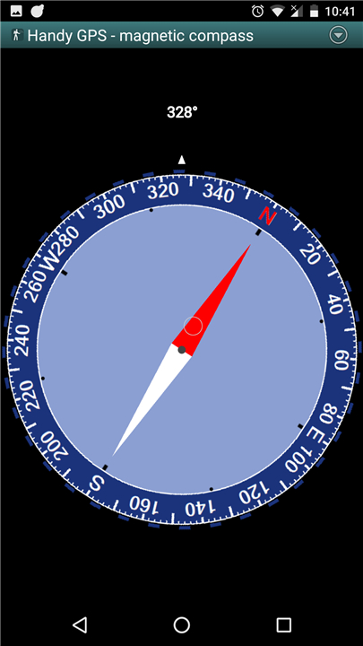
• Compass functionality available on devices with magnetic field sensors.
• Automatically calculates local geoid offset for improved altitude accuracy.
• Supports globally recognized WGS84 datum, along with popular datums and map grids in Australia and the US.
• Visual display of GPS satellite positions and signal strength.
• Simple and MGRS grid reference options.
• Calculate distance and direction between waypoints.
• Optional timer to record walking duration and compute average speed.
• Rigorously tested in challenging off-track environments by the developer.
Enhanced Features with This Version:
• Ad-free experience.
• Unlimited waypoints and track log points.
• Share your location via email or SMS as a clickable map link.
• Email your waypoints and tracklogs as KML or GPX files.
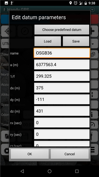
• Support for various datums including NAD83 (US), OSGB36 (UK), and NZTM2000 (NZ), with the option to configure custom datums.
• UK grid references with prefixes available when using OSGB datum.
• View elevation profiles.
• GPS averaging mode for better accuracy.
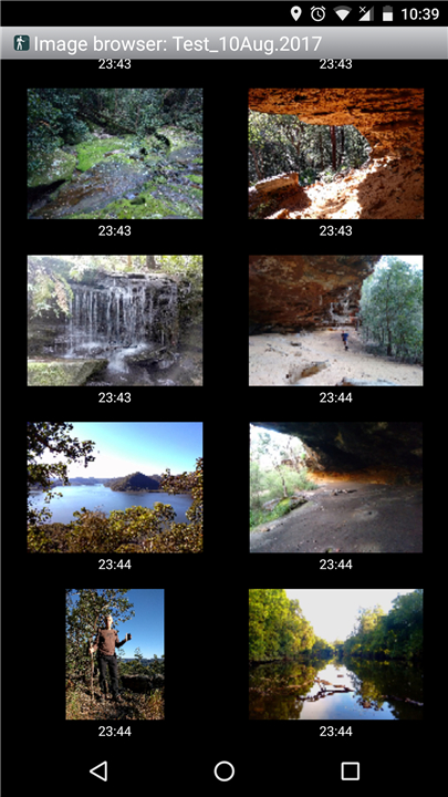
• Capture photos and voice memos, all geo-tagged for easy PC access.
• Burn coordinates and bearing into images for easy reference.
• Get sunrise and sunset times.
• Export data as a CSV file.
• Create waypoints through triangulation or by projecting distances and bearings.
• Analyze track log metrics like length, area, and elevation changes.
• Download offline maps or use your own map images.
• Calculate caloric expenditure.
• Optional background images and web location sharing.
• Spoken guidance for distance and direction on the "goto" page.
Permissions Needed:
• The app requires GPS access for location tracking, network access for loading maps, SD card access for storing waypoints, camera access for photos, the ability to prevent your phone from sleeping for proximity alerts, flashlight control, and audio recording for voice memos.
Disclaimer:
• Use this app at your own risk.
• The developer is not responsible for any loss or injury incurred while using the app.
• Mobile device batteries can deplete, so it’s advisable to bring a battery bank and an alternate navigation method, such as a paper map and compass, for longer or remote hikes.
FAQ
Q: Do I need to purchase a subscription to use Handy GPS?
A: Yes, an annual subscription is required to access all features of the app. However, the app will still function with limited capabilities if you do not purchase a subscription.
Q: What types of activities is Handy GPS suitable for?
A: Handy GPS is ideal for various outdoor activities, including hiking, cycling, kayaking, mountaineering, horseback riding, and geocaching. It is also useful for professional applications in surveying, mining, archaeology, and forestry.
Q: Does the app work without an internet connection?
A: Yes, Handy GPS is designed to function even in remote areas where network connectivity is unavailable. It relies solely on GPS for navigation.
Version History
v43.6——26 May 2025
A hiking and bushwalking GPS for the real world. No account creation required. Download the latest version of Handy GPS (subscription) to enjoy new features and updates immediately!
*43.6
When saving to a GeoJSON file, write tracklogs as LineString objects instead of Polygon objects.
* 43.5
Added an option to email current data as a GeoJSON file. Increased maximum precision of Easting, Northing, and Altitude to 3 decimal places on Advanced prefs page.
* 43.4
Added a button on the built-in file browser to allow emailing multiple files.


Ratings and reviews
There are no reviews yet. Be the first one to write one.