
Mapulator - GPS area Measure APK
9.0.15
Mapulator - GPS area Measure
Mapulator - GPS area Measure APK
Download for Android
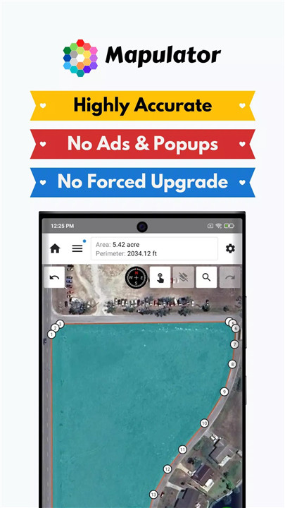
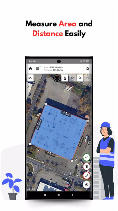
GPS Area Measure - Mapulator is a powerful and precise mobile tool designed for users needing to measure areas, distances, and perimeters on a map. Offering flexibility, accuracy, and user-friendly features, Mapulator transforms your phone into a robust tool for all your measurement needs.
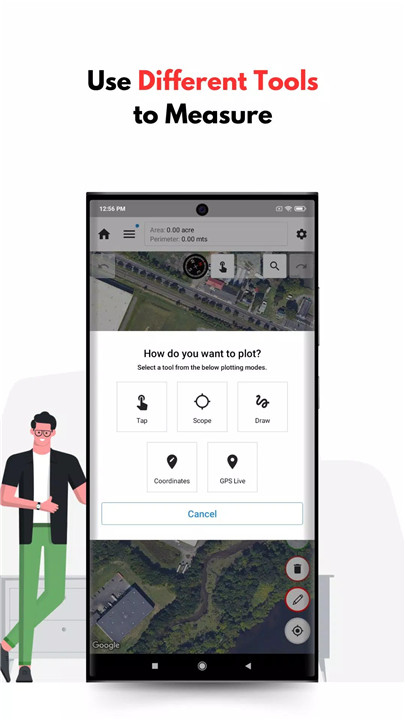
Five Measurement Tools
Mapulator offers five different measurement tools to help you with various tasks, such as calculating area, perimeter, distance, and radius. This versatility makes it ideal for professionals across a wide range of industries, from agriculture to construction.
Supports Multiple Units
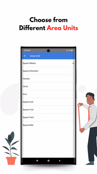
The app supports multiple area and distance units, including acres, hectares, square feet, kilometers, miles, and more. This ensures you can work with the measurement system that best suits your region and project needs.
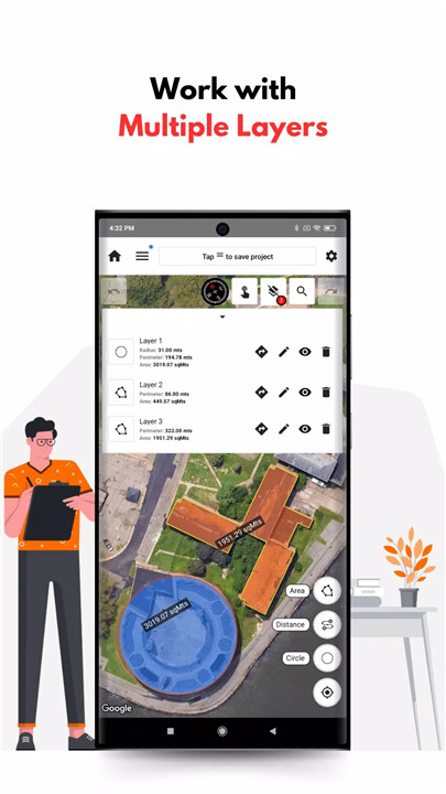
Organize Projects with Layers
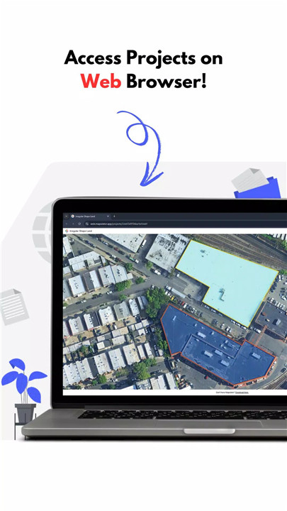
For users managing multiple measurements or projects, Mapulator allows you to organize your data with multiple layers within a single project. This helps keep everything organized, especially when you need to work with various areas or distances.
Customizable Appearance
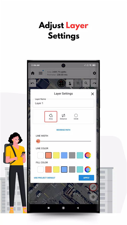
Mapulator enables full customization of your measurements. You can adjust the line width, color, and fill color, making it easier to visualize and differentiate between different areas, borders, and measurements.
Multiple Map Types
Choose from different map types, including satellite, terrain, and hybrid views. This flexibility ensures you can work with the map view that best suits your needs and offers clearer visual context for your measurements.
GPS Live Measurement
Mapulator’s live GPS feature allows you to measure land and areas in real-time as you walk or drive. This feature is perfect for outdoor use, such as measuring land while in the field.
Location Search
Easily search for any location to get accurate measurement results, making it easy to measure from any point on the map.
Export and Share Results
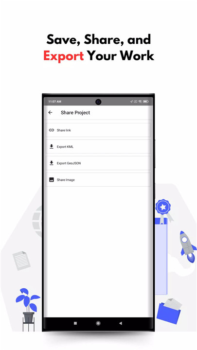
Once you've completed your measurements, you can export your data in KML or GeoJSON formats. These exports make it easy to share or further analyze your data on other platforms.
Undo/Redo Options
Mistakes happen, and with Mapulator, you can quickly undo or redo any changes. This feature ensures that your measurements are always accurate, and it prevents frustration when working on complex projects.
Who Can Benefit from Mapulator?
Farmers: Ideal for agro-measure map pro tasks, farmers can use Mapulator to measure land areas, plan planting, or calculate field dimensions.
Surveyors: Surveyors can use Mapulator for precise area and perimeter calculations, helping them complete their work with accuracy and ease.
Construction Professionals: Easily measure construction sites and plots to help plan layouts and manage projects effectively.
Real Estate Agents: Mapulator provides agents with precise property measurements, enhancing their ability to assist clients with buying or selling properties.
Outdoor Enthusiasts: Hiking and outdoor activity lovers can use Mapulator to measure trails, distances, and natural spaces with precision.
How to Use the App:
1. Select Tool: Choose from various tools such as area measure or distance measurement.
2. Mark Points: Tap on the map to mark points for measurement.
3. Customize Settings: Adjust the line width, color, and fill for clear, readable results.
4. Enable GPS Live: Use real-time GPS to measure land or areas while on the move.
5. Export/Save: Save your measurements or export them as KML or GeoJSON files for sharing.
FAQs
1. Can I measure distance on Google Maps?
Yes! Mapulator uses both Google Maps and Apple Maps as map providers, allowing you to easily measure distances on Google Maps.
2. What units of measurement are supported by Mapulator?
Mapulator supports a variety of units for both area and distance, including acres, hectares, square feet, kilometers, and miles.
3. Can I use Mapulator for real-time GPS measurement?
Absolutely! The live GPS feature allows you to measure areas and distances in real time as you walk or drive through the land or space you are measuring.
4. How do I export my measurements?
Once you've completed your measurement, you can export your data in either KML or GeoJSON formats, making it easy to share or analyze in other programs.
5. Can I undo or redo my actions in Mapulator?
Yes, Mapulator offers an undo/redo feature that allows you to correct any mistakes quickly and easily, ensuring your measurements are accurate every time.
Version History
v9.0.15—24 May, 2024
• We fixed a crash that occurs with scope based mapping.
Send us your feedback and any issues that you have, we will fix them for you. Happy Mapping!
v9.0.14—5 Jan, 2024
• We fixed a crash that occurs with scope based mapping.
Send us your feedback and any issues that you have, we will fix them for you. Happy Mapping!
v9.0.12—13 Oct, 2023
• Presenting you the all new 9.0! We've made significant changes to UI and functionality to make the app more easy to use.
Send us your feedback and any issues that you have, we will fix them for you. Happy Mapping!


Ratings and reviews
There are no reviews yet. Be the first one to write one.