i-Boating:Marine Navigation APK
269.0
i-Boating:Marine Navigation
i-Boating:Marine Navigation APK
Download for Android
The Ultimate Marine Navigation App
Transform your device into a powerful chartplotter with the #1 Marine Charts App.
Offering comprehensive offline nautical and inland water charts, advanced navigation features, and cutting-edge fishing tools, it's designed for unparalleled confidence on the water.
Core Navigation & Charting
• Comprehensive Charting:
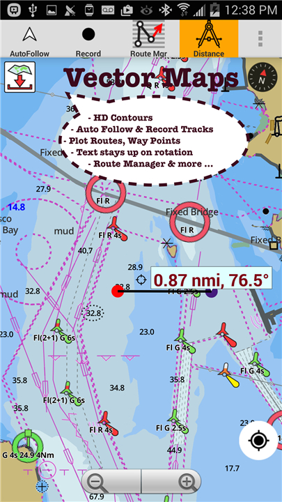
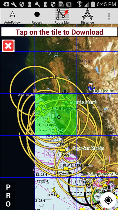
- Access GPU-accelerated offline vector NOAA/ENC charts, ensuring smooth performance with text that always stays upright.
- Enjoy seamless chart quilting across coastal, approach, harbor, and inland Electronic Marine Charts (ENC).
• Navigation Essentials:
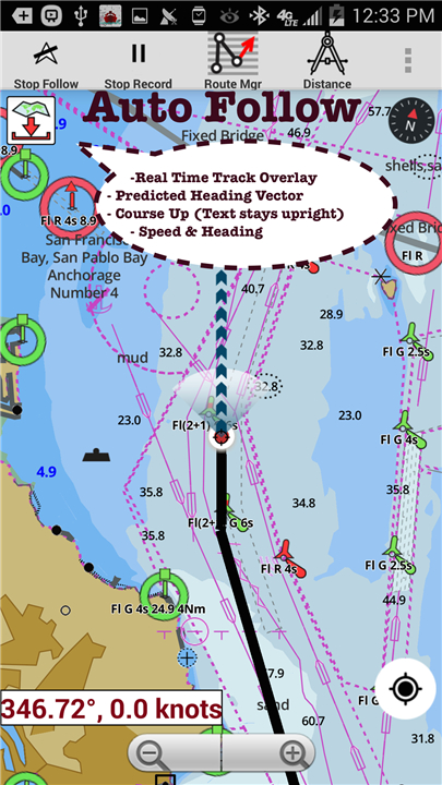
- Benefit from course-up orientation, real-time track overlay, and clear display of maritime aids like beacons, buoys, boat launch areas, boat ramps, and marinas.
• Intelligent Route Assistance:
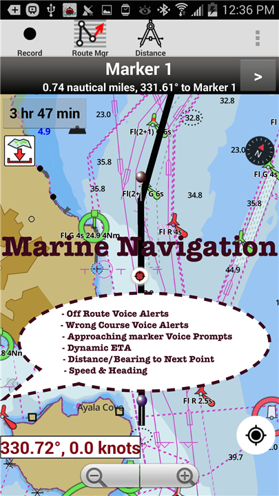
- The only marine navigation app offering voice prompts for turn-by-turn guidance.
- Receive real-time nautical distance, ETA, and crucial alerts if you're off-route or heading in the wrong direction.
• Flexible Route Management:
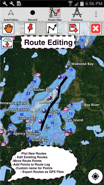
- Easily create, edit, and reverse boat routes and waypoints.
- Import existing GPX, KML, and KMZ files, and share your routes, boating logs, tracks, and markers.
• Auto-Follow & Tracking:
- Utilize auto-follow functionality with real-time track overlays and predicted path vectors.
- Record your marine tracks for future reference.
Dedicated Fishing Tools
• Advanced Fishing AI:
- Leverage our exclusive Fishing Hot Spots AI and detailed Lake Temperature Maps (Thermoclines 1°F / 0.5°C) to pinpoint optimal fishing locations.
• Precision Lake Mapping:
- Access high-definition 1ft/3ft depth lake contour maps for anglers (freshwater/saltwater), complete with customizable safety depth contours and relief shading.
Real-time Data & Instrumentation
• Marine AIS Integration:
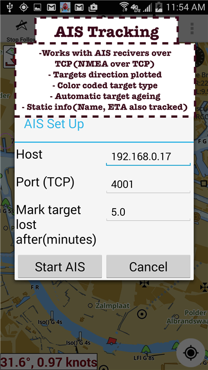
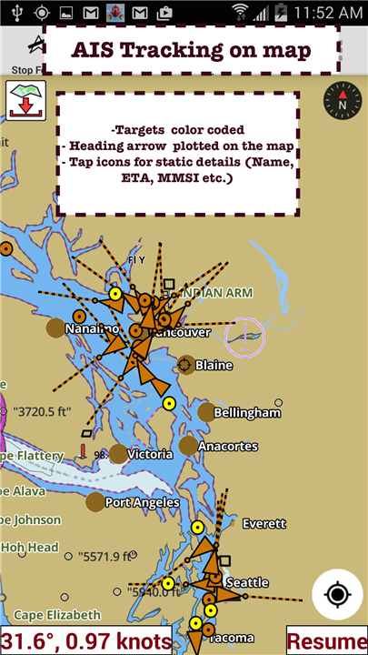
- Full Marine AIS (NMEA) support via TCP/UDP for real-time vessel tracking.
• Environmental Insights:
- Get precise Tide Charts & Current predictions (high/low tides, tidal current prediction) and advanced Marine Weather forecasts (GFS + ECMWF).
• Onboard Data:
- View live instrumentation data including wind direction & speed, marine sonar depth, and water temperature.
• Safety Features:
- Includes a reliable Anchor Alarm for peace of mind.
Extensive Global Map Coverage
Experience chartplotter-level detail with unlimited updates for one year.
• USA:
- Comprehensive NOAA marine charts (vector & raster), ENC, USACE inland river maps, and freshwater lake bathymetry for over 75,000 lakes, including HD 1ft bathymetry. (e.g., Lake Michigan, Lake Powell, Texoma, Okeechobee, Minnetonka).
• Canada:
- CHS data including Great Lakes, Alberta & Ontario lakes, Lake Simcoe & Trent Severn Canal, Quebec reservoirs, Rideau Canal, British Columbia, and more.
• UK/Ireland:
- UKHO marine charts covering Scotland, Thames Estuary, and all of Ireland.
• Europe:
- BSH charts (Germany), Waterways & rivers (Germany), France, Europe Inland Rivers (Donau/Danube, Rhine), Netherlands, Croatia, Finland, Norway, Sweden, Denmark, Greenland, Faroe, Estonia, Latvia, Poland, Lithuania, Turkey, Greece, Italy.
• Other Regions:
- Australia (NSW, Queensland), Brazil, Spain, Malta, Cyprus, Mediterranean Sea, Caribbean, New Zealand, Seychelles, Mauritius, Tanzania, Falklands, Malaysia, South China Sea, Persian/Arabian Gulf, Red Sea, South Africa, Argentina, Iceland, Fiji.
Additional Features
• Magnify Text & Icons
• Wind Prediction Overlay
• Bearing True/Magnetic
• Satellite Imagery
• Export GPX Files
The Superior Choice
• Designed to be a superset of leading navigation apps like Navionics, C-Map, Lowrance, Argo, Wavve, Savvy Navvy, Predict Wind, and Windy, offering unparalleled features and value in one powerful application.
FAQ
Q: What makes this marine navigation app the best choice?
A: Our app combines offline NOAA/ENC charts, AI-powered fishing tools, real-time AIS & weather data, and voice-guided navigation—all in one seamless platform. It’s designed to outperform competitors like Navionics and C-Map with enhanced features, global coverage, and yearly updates.
Q: Does the app work offline?
A: Yes! All nautical charts, lake maps, and navigation tools are fully downloadable for offline use, ensuring reliability even without internet connectivity.
Q: What types of charts are available?
A: Access vector & raster NOAA charts, ENC (Electronic Navigational Charts), inland river maps (USACE), and high-definition bathymetry (1ft contours for lakes).
Version History
v269.0——14 Jul 2025
Chartplotter:Lake depth Maps 4 Fishing,Nautical/Marine Charts w/ Marine Weather Download the latest version of i-Boating:Marine Navigation to enjoy new features and updates immediately!
*269.0
AIS updates
Highlight Fishing Depth Range
RELIEF SHADING
Lake Temperature
Marine Weather Forecast
Fishing AI
NMEA ALARMS:Depth+Wind
Marine Weather:Wind,Wave
Automatic Boat Routing
-UK Tide & Currents
-Magnetic Bearing
-Wind Prediction Overlay
-Magnify Text+Icons
-Anchor alarm
- Auto Pilot
-Custom depth shading
-Satellite imagery
-AIS &GPS NMEA TCP/UDP
-Russian rivers(Volga)
-Wind speed,direction,sonar depth,water temp
Norway,Finland,Denmark
German(Donau,Elbe,Mosel,Rhein,Saar,Weser)
Elbe,Ruhr
*266.0
AIS updates
Highlight Fishing Depth Range
RELIEF SHADING
Lake Temperature
Marine Weather Forecast
Fishing AI
NMEA ALARMS:Depth+Wind
Marine Weather:Wind,Wave
Automatic Boat Routing
-UK Tide & Currents
-Magnetic Bearing
-Wind Prediction Overlay
-Magnify Text+Icons
-Anchor alarm
- Auto Pilot
-Custom depth shading
-Satellite imagery
-AIS &GPS NMEA TCP/UDP
-Russian rivers(Volga)
-Wind speed,direction,sonar depth,water temp
Norway,Finland,Denmark
German(Donau,Elbe,Mosel,Rhein,Saar,Weser)
Elbe,Ruhr
*265.0
MAJOR UPDATE:Highlight Fishing Depth Range
RELIEF SHADING
Lake Temperature
Marine Weather Forecast
Fishing AI
NMEA ALARMS:Depth+Wind
Marine Weather:Wind,Wave
Automatic Boat Routing
-UK Tide & Currents
-Magnetic Bearing
-Wind Prediction Overlay
-Magnify Text+Icons
-Anchor alarm
- Auto Pilot
-Custom depth shading
-Satellite imagery
-AIS &GPS NMEA TCP/UDP
-Russian rivers(Volga)
-Wind speed,direction,sonar depth,water temp
Norway,Finland,Denmark
German(Donau,Elbe,Mosel,Rhein,Saar,Weser)
Elbe,Ruhr





Ratings and reviews
There are no reviews yet. Be the first one to write one.