
Coordinate Converter Plus APK
153-lemon
Coordinate Converter Plus
Coordinate Converter Plus APK
Download for Android
Coordinate Converter Plus is an innovative Android application designed to function as a highly versatile coordinate converter and elevation calculator. It is particularly useful for professionals and outdoor enthusiasts alike who require accurate geographical data for their activities.
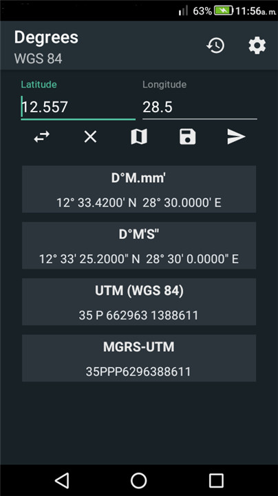
The app adeptly supports a variety of coordinate formats, ensuring that users can seamlessly work with the system that best fits their needs.
These formats include:
• Latitude and Longitude:
+ Decimal degrees (DD.ddd)
+ Degrees decimal minutes (DD.mmm)
+ Degrees Minutes Seconds (DD MM SS)
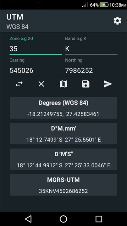
• UTM (Universal Transverse Mercator):
+ A widely-used map projection that divides the world into a series of zones for more accurate location representation.
• MGRS (Military Grid Reference System) UTM:
+ This system enhances UTM coordinates by integrating grid references, making it easier for military and navigational purposes.
Key Features
Coordinate Converter Plus boasts a rich array of features that enhance its usability and functionality:
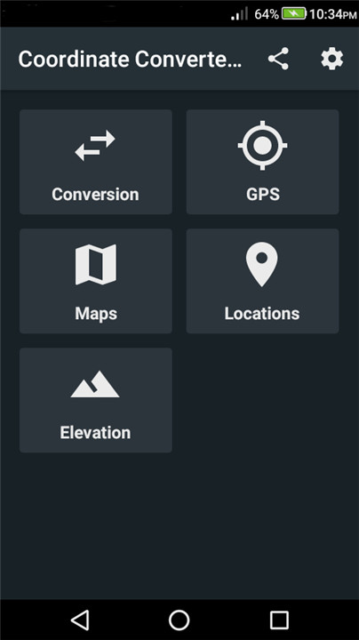
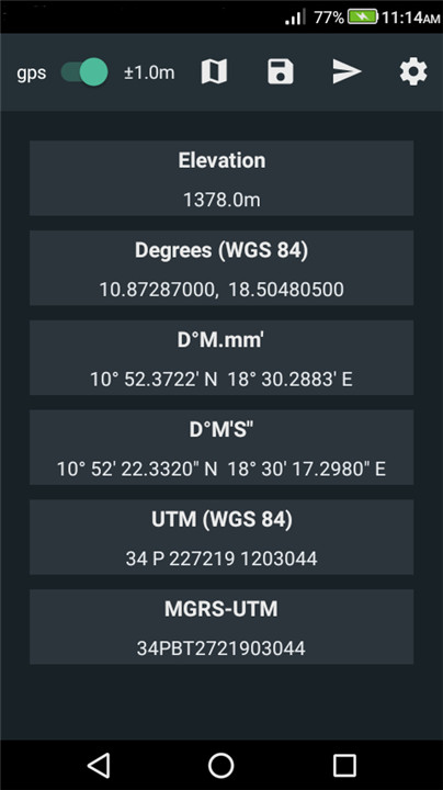
• GPS converter
• Latitude and Longitude converter
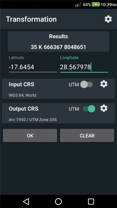
• UTM converter (compatible with WGS84 and ARC 1950)
• MGRS converter
• Datum transformation
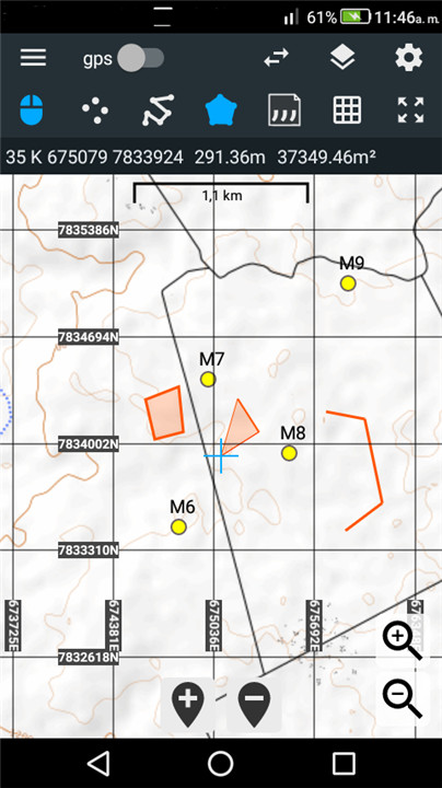
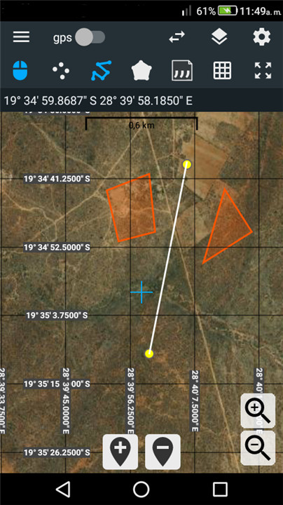
• Integrated maps
• Conversion of map coordinates
• Support for map layers such as points, polylines, and polygons
• Feature labels for enhanced visualization
• Import and export options for layers
• Map grid with multiple coordinate formats along the x-y axis
• Calculation of segment lengths for polylines and polygons
• Polygon area computation
• Distance and bearing calculations directly on the map
• Digitizer tools
• Ability to create map projects
• Automatic project saving
• Sharing of projects
• Sharing of coordinates
• Import and export of coordinates
• Saving of locations
• Pasting coordinates from the clipboard
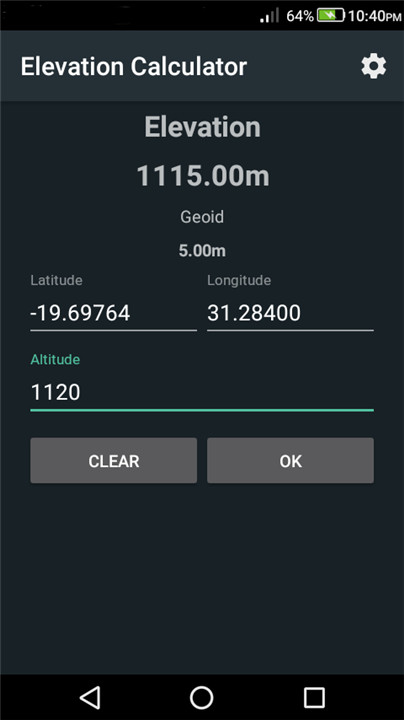
• Elevation calculator
• Geoid altitude correction based on the EGM96 model
Ideal Applications
Coordinate Converter Plus is suitable for a variety of practical applications, making it a must-have tool for:
• Mapping
• Geo-caching
• Hiking
• Camping
• Navigation
• Air rescue operations
• Surveys
Coordinate Converter Plus is an essential tool for individuals in various fields, providing a comprehensive suite of features that facilitate accurate geographical data handling. Whether you're a casual hiker or a professional surveyor, this app equips you with the necessary tools to manage and convert coordinates with ease and precision.
FAQ
Q: Who can benefit from using Coordinate Converter Plus?
A: The app is ideal for a wide range of users including hikers, campers, geo-caching enthusiasts, navigation professionals, surveyors, and those involved in air rescue operations. It is designed for anyone needing accurate geographical data.
Q: Can I calculate elevation with Coordinate Converter Plus?
A: Yes, the app includes an elevation calculator and provides geoid altitude correction based on the EGM96 model, making it useful for users needing precise elevation data.
Q: Is it easy to share coordinates and projects using the app?
A: Absolutely! Coordinate Converter Plus allows users to share coordinates and project files easily, facilitating collaboration and information exchange.
Version History
v153-lemon——24 Apr 2025
Coordinate converter, elevation calculator and mapping app for Android Download the latest version of Coordinate Converter Plus to enjoy new features and updates immediately!
*153-lemon
Updated UTM grid axis labelling
Added area conversion to acres
Bug fixes
UI update
*149-lemon
Updated UTM grid axis labelling
Added area conversion to acres
Bug fixes
*144
Added more precision settings for lat/lon coordinates
Added input/output in feet for for UTM and Tmerc coordinates
Added Gauss Conform Coordinate System for South Oriented systems.
Bug fixes





Ratings and reviews
There are no reviews yet. Be the first one to write one.