Enhanced Bluetooth GNSS for Superior Location Accuracy
Overview
• Bluetooth GNSS technology allows users to connect compatible external GPS/GNSS receivers to their Android devices, significantly improving location accuracy for mapping and navigation applications.
• This solution is ideal for professionals and enthusiasts who require higher precision than standard smartphone GPS can provide.
Key Features
• Multi-Constellation Support – Works with GPS, Galileo, GLONASS, and BeiDou satellite systems for enhanced positioning reliability.
• Android Compatibility – Fully supports Android 14 (tested on Samsung Galaxy S24).
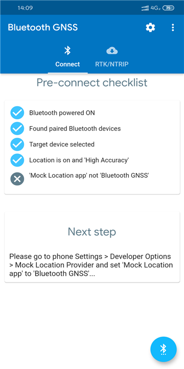
• Mock Location Integration – Utilizes Android’s Developer Option for "mock location" to feed precise GNSS data into Maps and Navigation apps.
• RTK (Real-Time Kinematic) Support – Enables centimeter-level accuracy when used with RTK-capable GNSS devices and NTRIP (Networked Transport of RTCM via Internet Protocol) correction streams.
Tested Bluetooth GNSS/GPS Devices
The following devices have been verified for compatibility:
• Bad Elf GPS PRO+ – High-precision GNSS receiver with multi-constellation support.
• Bad Elf Flex – Compact and portable GNSS solution for fieldwork.
• u-blox M8030 – Professional-grade GNSS module with high sensitivity.
• ArduSimple u-blox F9 – Supports RTK and NTRIP for survey-grade accuracy.
Advanced Accuracy Reporting (u-blox Devices Only)
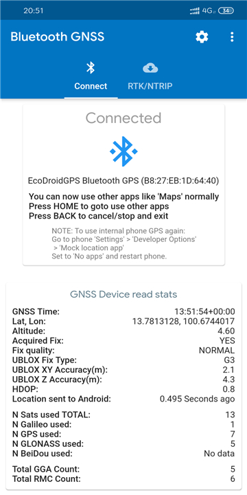
• Instead of relying on the traditional HDOP × CEP (Horizontal Dilution of Precision × Circular Error Probable) method, the app extracts PUBX accuracy messages directly from u-blox devices.
• This metric matches the same accuracy value displayed in the U-Center PC software when connected via USB, ensuring consistency and reliability.
RTK & NTRIP Support for Professional Applications
• Ideal for surveying, drone mapping, and precision agriculture.
• Requires an RTK-enabled GNSS device (e.g., ArduSimple u-blox F9) and an NTRIP correction service.
• Accuracy can reach centimeter-level depending on the GNSS hardware and correction data quality.
Use Cases
• Field Surveying – Achieve high-precision measurements for land surveys.
• Autonomous Vehicles & Drones – Improve navigation accuracy in robotics and UAV applications.
• Outdoor Navigation – Enhanced hiking, geocaching, and off-road navigation experiences.
• Fleet Tracking – More accurate logistics and asset tracking.
For users who demand superior location accuracy beyond standard smartphone GPS, Bluetooth GNSS solutions provide a powerful alternative.
With support for RTK, multi-constellation signals, and compatibility with leading GNSS hardware, this technology ensures professional-grade positioning for various applications.
FAQ
Q: How does mock location integration work?
A: Android’s Developer Option for "mock location" allows the GNSS receiver to feed high-accuracy positioning data directly into mapping apps (Google Maps, Waze, or GIS applications). This bypasses the smartphone’s internal GPS, ensuring superior precision.
Q: What is RTK, and how does it improve accuracy?
A: Real-Time Kinematic (RTK) is an advanced GNSS correction technique that processes real-time corrections (via NTRIP streams) to achieve 1-3 cm accuracy. This is ideal for surveying, drone mapping, and precision agriculture.
Q: Do I need an internet connection for RTK corrections?
A: Yes, RTK requires an internet connection (Wi-Fi/mobile data) to receive NTRIP correction data from a base station or correction service. However, the GNSS receiver can still function without corrections, but with reduced accuracy (~1-3 meters).
Version History
v2.1.4——12 Aug 2025
Connect to Bluetooth GPS receivers. Download the latest version of Bluetooth GNSS to enjoy new features and updates immediately!
*2.1.4
- restore auto reconnect feature
- add top disconnect button to stop auto reconnect job
*2.1.2
- updated targetsdk as per new googleplay requirements
- removed old 'location high accuracy mode' check as doesnt work with current targetsdk on many phones
- temporarily remove autoreconnect feature until recode/retested well - user reported no button/way to stop it
*2.1.0
- better support for fused location providers (google maps) but need more testing
- new map view, can long tap to set lat lon offsets
- settings can set time location time offset
- app structure overhaul and ui redraw now reactive per params without needing full rebuild of screen components


Ratings and reviews
There are no reviews yet. Be the first one to write one.