
FLY is FUN Aviation Navigation APK
34.40
FLY is FUN Aviation Navigation
FLY is FUN Aviation Navigation APK
Download for Android
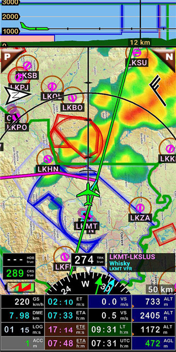
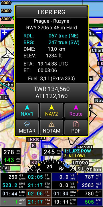
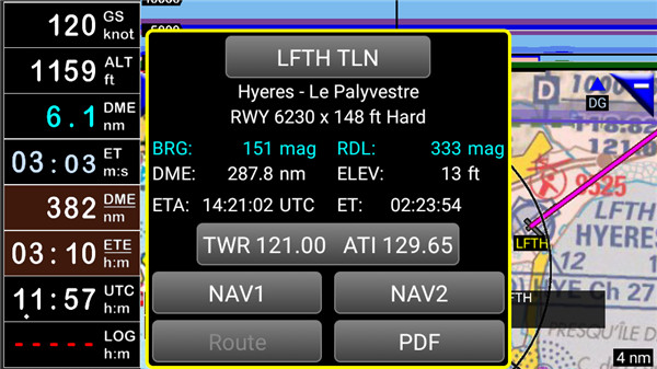
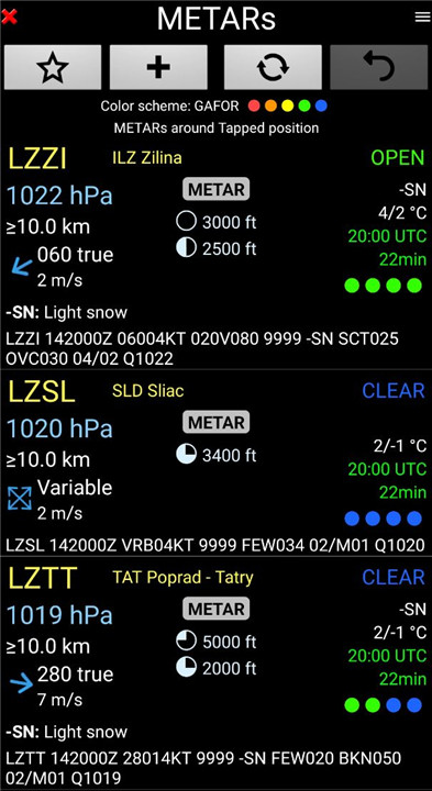
FLY is FUN is crafted by pilots specifically for pilots. This application streamlines flight preparation and enhances situational awareness during flights by offering vital information such as airspace details, reporting points, real-time positioning on a moving map, elevation data, frequencies, railway information, and weather updates. It also provides easy access to PDF documents related to airfields. Additionally, FLY is FUN displays NOTAMs and rainfall radar data.
The app simulates ILS approaches, VOR, NDB, DME, marker beacons, RNAV navigation, and marker beacon warnings, even without onboard ILS/VOR/NDB/RNAV equipment.
You can try FLY is FUN for free for a limited time. After the trial period, pilots are encouraged to subscribe and pay an annual fee, granting them the right to use the application "as is" and support its ongoing development.
FLY is FUN offers a variety of features, including:
- Route creation and modification through "drag and drop" and "rubber band" techniques
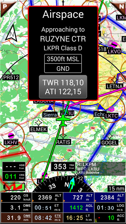
- Alerts and radio information before entering controlled or special use airspaces and approaching points
- Route planning with assessments of distance, time, and fuel consumption based on wind and aircraft specifications
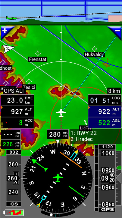
- Visualization of routes, bearings, and traces on a moving map
- Dynamic airspace visualization
- A terrain map that changes color based on elevation above ground level
- STRATUX support
- Flight plan creation and export
- Flight log creation and export
- Route, waypoint, runway, and airspace creation, import, or export (supports Garmin .gpx, .kml, txt, OpenAir formats)
- Flight recording and playback using Google Earth
- Sunset and sunrise times
- Weather forecasts along the route
- Rainfall radar information
- Wind display
- Distance calculations between two map points
- VACs
- Notepad functionality
…
All primary screens (five in portrait and five in landscape) can be easily customized.
Pilots can select from approximately 100 display options, such as:
- GPS or barometric altitude
- Ground speed
- Bearing
- Vertical speed
- DME to the next point or destination
- Estimated time to the next point or destination
- Time since departure
- Stopwatch
…
The information displayed can be tailored to suit user preferences, whether for VFR, IFR, or both, as well as the zoom level. The closer you zoom in, the more detailed information, waypoints, and other data become visible.
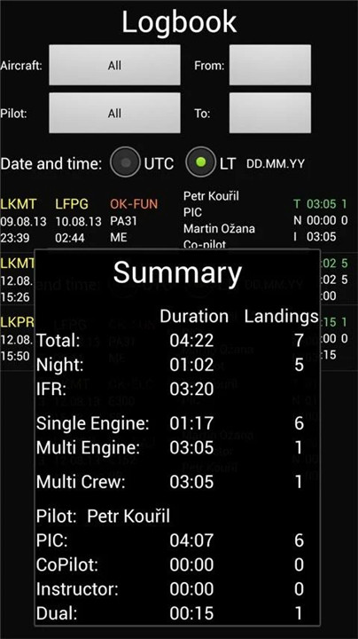
Logbook
The built-in logbook enables users to record:
- Duration since departure
- Departure and arrival times
- Departure and arrival airports
- Flight path (which can be exported as .kml or .gpx for replay)
- Aircraft used
- Pilot(s) and co-pilots responsible
- Distance traveled, average speed, and maximum speed
…
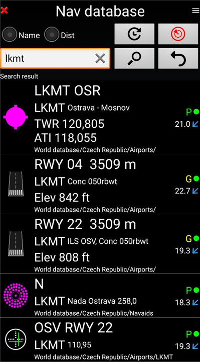
Navigation data sourced from open databases is refreshed according to AIRAC cycles.
Charts and Elevation Data
Free charts and elevation data are accessible for most countries and can be imported directly through the application store. Pilots can also create and import their own charts or request commercial services for additional charts.
Pilots have the option to choose from various charts, including free open-source options and commercial charts such as ICAO, Cartabossy, SkyVector, and FAA sectional and terminal charts.
VACs and PDF Files
VAC and AIP information is available for over 50 countries, and users can easily attach their own PDF files.
The application supports the use of external GPS devices connected via Bluetooth.
User guide: http://www.funair.cz/downloads/manuals/flyisfun.pdf
For suggestions to enhance this application or to report any bugs, please visit www.flyisfun.com.
This application is intended for VFR flying only! We are not liable for any misuse of this application.
FAQ
Q: Can I try FLY is FUN for free?
A: Yes, you can try FLY is FUN for free for a limited time. After the trial period, an annual subscription is required to continue using the application and support its ongoing development.
Q: How does the app enhance situational awareness?
A: FLY is FUN enhances situational awareness by providing real-time information such as airspace details, weather updates, NOTAMs, and precise positioning on a moving map, allowing pilots to make informed decisions during flights.
Q: Does the app support navigation simulations?
A: Absolutely! The app can simulate ILS approaches, VOR, NDB, DME, RNAV navigation, and more, even without onboard equipment, making it a valuable tool for training and proficiency.
Version History
v34.40——21 Apr 2025
FLY is FUN - navigation for pilots 30 days trial version Download the latest version of FLY is FUN Aviation Navigation to enjoy new features and updates immediately!
*34.40
- New: The Czech AUP (Airspace Use Plan) is shown on the map as https://aisview.rlp.cz/.
- If you do not want Czech AUP downloading, Preferences / AUP / uncheck Czech AUP
- NOTAMs and AUPs can be displayed on the map for any time or time interval. To set the time you want, you need to display the NTM value window on the map screen.
- Refactored airspace colors. They are more customizable than before.
- NOTAM filter improved. Valid time was replaced by time interval.
- Removes bugs
*34.21
- Updated German, Spanish, French, Italian, Polish and Slovenian version. Thanks to Juergen, Rolando, Antoine, Marco, Krzysztof and Jernej.
- Better parsing NOTAM text.
*34.20
- If the NOTAM contains coordinates, it is shown as an area on the map. If it is small and you are using high zoom, this NOTAM is displayed as an icon.
- Application displays NOTAM altitudes if the altitudes are available.
- Added altitude filter for NOTAMs.
- NOTAM list box, possible share NOTAMs using KML format. Swipe to select them nd press Share button at the bottom.
- Better NOTAM grouping at the map.





Ratings and reviews
There are no reviews yet. Be the first one to write one.