Elevation and Sea Depth APK
5.1.2
Elevation and Sea Depth
Elevation and Sea Depth APK
Download for Android
Visualize Your World: Real-Time Elevation & Depth Profile
Unlock a new perspective on your surroundings with this powerful utility
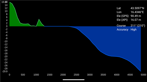
• The app instantly generates a real-time elevation and bathymetry (sea depth) profile of the landscape directly in front of you.
• By simply pointing your phone, you can see a cross-section of the terrain, revealing hills, valleys, underwater drop-offs, and everything in between. It's an indispensable tool for adventurers, explorers, and anyone curious about the topography around them.
Key Features
• Dynamic Terrain Scanning:
- Visualize the landscape with a comprehensive range of up to 5 kilometers, giving you an excellent preview of the path ahead.
• Adjustable Data Resolution:
- Tailor the level of detail to your specific needs.
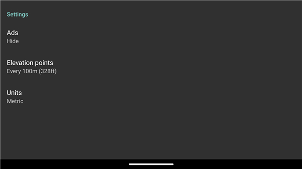
- Choose high-density elevation points every 10 meters for a granular, close-range view, or select 100-meter intervals for a broader, long-distance overview.
• Intuitive Directional Compass:
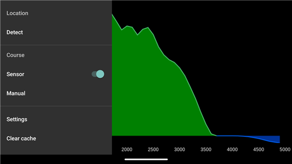
- To ensure clarity and ease of use, the display simplifies directions into 30-degree increments (e.g., North, North-Northeast, etc.), allowing for quick and confident orientation.
Ideal For a Wide Range of Activities
This tool is designed to enhance safety, planning, and discovery across numerous outdoor pursuits:
• Hiking & Trekking:
- Anticipate steep climbs and descents on the trail, identify ideal resting spots, and better plan your energy expenditure.
• Mountaineering:
- Assess the grade of an upcoming ascent, understand the shape of ridges, and gain crucial topographic insight for safer climbs.
• Fishing & Boating:
- Switch to bathymetry mode to "see" the seabed. Locate underwater ledges, channels, and drop-offs where fish are likely to congregate, giving you a distinct advantage on the water.
Instructions for Optimal Accuracy
To ensure the most reliable readings from your device's internal sensors, please follow these guidelines:
• Hold your phone as level and flat as possible, parallel to the ground.
• Operate the app away from large ferrous metal objects (e.g., cars, bridges, metal structures).
• Avoid proximity to strong electromagnetic fields, such as those from power lines or other electronic equipment, as they can interfere with compass accuracy.
FAQ
Q: How does the app generate elevation and depth profiles?
A: The app utilizes your device's internal sensors to scan the terrain and generate a cross-section of the landscape. It provides insights into the elevation and bathymetry based on your current orientation and position.
Q: What is the maximum distance the app can visualize?
A: The app can visualize the terrain up to a range of 5 kilometers, allowing you to preview significant features of the path ahead.
Q: Can I customize the level of detail in the elevation data?
A: Yes, the app allows you to adjust the data resolution. You can choose to display high-density elevation points every 10 meters for detailed views or opt for a broader overview with points every 100 meters.
Version History
v5.1.2——10 Jul 2025
Displays terrain/elevation profile in direction of phone. Download the latest version of Elevation and Sea Depth to enjoy new features and updates immediately!
*5.1.2
* not overlapping user interface with android system buttons
*5.1
* using banner instead of interstitial ad
* updating app icon
* updating chart colors
* improving chart drawing for elevation 0
* bug fix: checking if network provider is available
* bug fix: not requiring calibration on devices with unreliable accelerometer
* updating Google Play Billing library
*5.0.1
Integrating activation of previous non-google purchases.


Ratings and reviews
There are no reviews yet. Be the first one to write one.