
Green Tracks - hiking partner APK
V11.12
Green Tracks - hiking partner
Green Tracks - hiking partner APK
Download for Android
Green Tracks is a comprehensive mobile application designed to be your indispensable companion for outdoor adventures like hiking, climbing, and exploring.
It transforms your smartphone into a powerful navigation tool, helping you stay on track, explore new routes, and safely navigate any terrain.
Key Features & Capabilities:
1. Core Navigation & Tracking
• Track File Analysis:
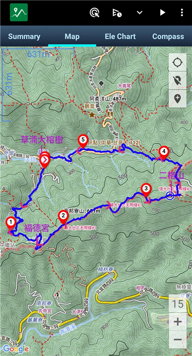
- Reads and analyzes GPX, KML, KMZ, and other track files from your mobile phone, drawing the analyzed content directly onto the map.
• Real-time GPS Positioning:
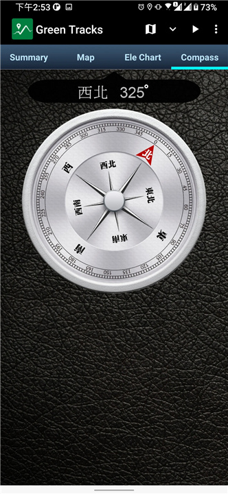
- With accurate GPS satellite positioning, you always know your precise location relative to the track line, significantly reducing the risk of getting lost.
- It serves as an invaluable reference for all outdoor activities.
• Off-track Alarm:
- Stay safely on course with an alert function that notifies you if you deviate from your pre-loaded GPX track.
2. Comprehensive Map Support
• Offline Maps:
- Navigate confidently even without an internet connection. Green Tracks supports:
+ Mapsforge Files: Download OpenAndroMaps world maps directly within the app.
+ MBTiles Format: Create and use custom MBTiles offline maps (ensure MBTiles SQLite format is selected when creating with tools like Mobile Atlas Creator - MOBAC).
+ Offline Search: Install Mapsforge's POI (Point of Interest) files to search for locations even when offline.
• Online Maps:
- Access a variety of popular online mapping services for diverse perspectives:
+ Google Road Map
+ Google Satellite Map
+ Google Hybrid Map
+ Google Terrain Map
• Map Overlays:
- Enhance your view by layering maps, supporting offline maps stacked on top of online maps, or multiple offline maps simultaneously.
3. Track Management & Creation
• Record Your Journey:
- Effortlessly record your own treks and adventures.
• Edit & Merge Tracks:
- Modify your recorded tracks, allowing you to edit or merge multiple segments.
• Versatile File Support:
- Green Tracks can parse and display various track file formats, including GPX, KML, and KMZ.
• Export & Share:
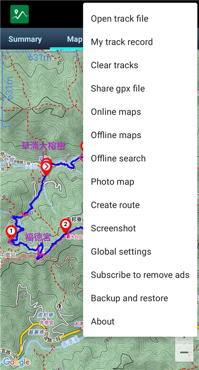
- Save your recorded tracks in widely compatible formats such as GPX, KML, or KMZ through the export function.
• Backup & Restore:
- Securely backup and restore your self-recorded track history.
4. Advanced Navigation & Safety Features
• Route Planning:
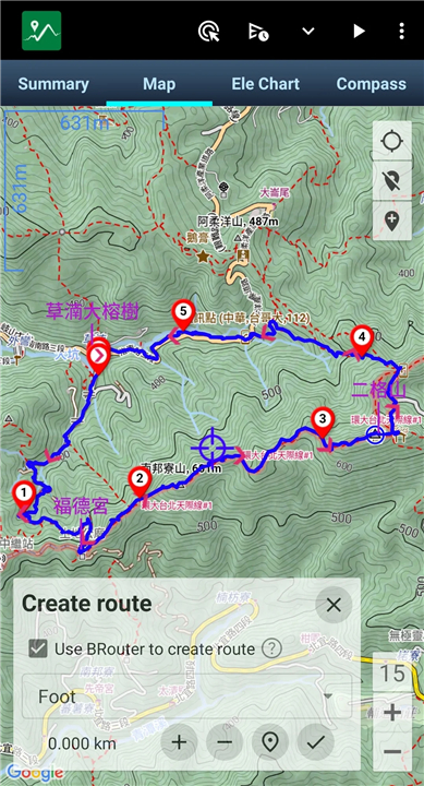
- Integrate with BRouter to plan detailed routes directly within Green Tracks, then export them as GPX, KML, or KMZ files.
• Real-time Location Sharing:
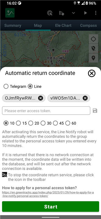
- Automatic/Manual Coordinate Reporting: Keep family members or friends informed of your whereabouts (requires network signal for automatic reporting), allowing those left behind to track your traces at any time.
- Mark Locations: Easily mark reported coordinates from family members or friends on your map, automatically or manually, making it easier to track their whereabouts.
• Coordinate Conversion:
- Seamlessly convert between various coordinate formats, including WGS84, TWD67, TWD97, and UTM geodetic datums.
5. Data Visualization & Enhancement
• Photo Map:
- Visualize your journey's memories by scanning photos on your phone and displaying them on the map at their geotagged locations.
• Altitude Correction:
- Improve the accuracy of your altitude readings using HGT elevation files.
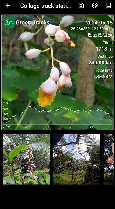
• Collage Statistics & Photos:
- Combine activity statistics with waypoint photos or other images into a single, shareable photo.
6. Sharing & Export Options
• Share Your Tracks:
- Easily share your GPX records with other users, or download GPX files from others for tracking.
• Comprehensive Screenshots:
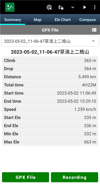
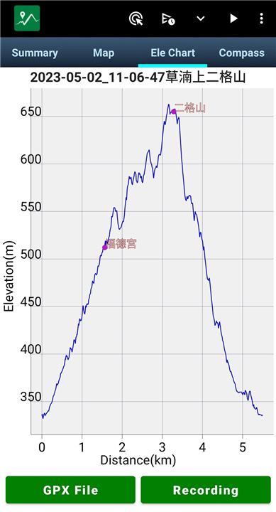
- Capture and collage detailed screenshots of your walk's "Summary," "Map," and "Ele Chart" into a single photo for easy sharing on various online platforms.
• Google Earth Integration:
- Export your Green Tracks records as KML or KMZ files to create dynamic track videos using Google Earth Pro (PC version).
Learn More:
• For offline map production methods, please refer to: https://sky.greentracks.app/?p=2895
• Google Earth video reference: https://youtu.be/f-qHKSfzY9U?si=MO7eQQVSHEyZ57DK
• Visit our website: https://en.greentracks.app/
FAQ
Q: Can I record my own treks and adventures with Green Tracks?
A: Yes, you can effortlessly record your own journeys. Green Tracks also allows you to edit and merge recorded tracks, supporting parsing and display of GPX, KML, and KMZ formats.
Q: Does Green Tracks have route planning capabilities?
A: Yes, Green Tracks integrates with BRouter, allowing you to plan detailed routes directly within the app. These planned routes can then be exported as GPX, KML, or KMZ files.
Q: Can Green Tracks help me visualize my journey's memories?
A: Yes, with the Photo Map feature, Green Tracks can scan photos on your phone and display them on the map at their geotagged locations, allowing you to relive your adventure visually.
Version History
vV11.12——14 Jul 2025
You can import gpx file and display tracks on Google Maps.Support offline maps. Download the latest version of Green Tracks - hiking partner to enjoy new features and updates immediately!
*V11.12
1. Fine-tuned KML and KMZ files used by Google Earth Tour.
2. Other issues fixed
*V11.11.1
1. Save the last ten search keyword records, including "My track records", "Offline search" and "share gpx file".
2. Other issues fixed
*V11.10.1
1.Upgrade Mapsforge 0.25.0 with custom hillside shadows (global settings).
2. Edit the track points of my record will display time, coordinates and altitude.
3. Reminder when recording Ignore the battery optimization settings to avoid straight-line problems.
4. Open the installation of Green Tracks on tablets without GPS.
5. Other issues fixed.


Ratings and reviews
There are no reviews yet. Be the first one to write one.